Samapa: Or the Asokan Kalinga
Ramdas, G.
Imdian Antiquary
1923.04/05
pp.66-70; 87-91
.
p.66

            IN  the  Kalinga   edicts  of  Asoka,  containing
        instructions  to  the  of ficers  entrusted  with  the
        control  of the tribes  on the  borders, it is stated
        that these officers  were located  at a place  called
        Samapa,  and  the  Provincials'  Edict  says  that  a
        viceroy  was placed  at Tosali.  Thus  the two  chief
        towns  of Kalinga  are mentioned, but their  location
        being  undefined, they have not yet been  identified,
        and the limits of Kalinga  have become  a matter  for
        speculation.

            The first of the speculators  was W.  W.  Hunter,
        who  in  the  Imperial  Gazetteer   of  India,  1886,
        identified  Coringa  or Rajahmandry, in the  Godavari
        district, with  the  old  capital  of  Kalinga,  thus
        taking the southern  boundary  of Kalinga  beyond the
        Godavari.  Vincent  A.Smith  asserts  that Kalinga
        extended  from the Mahanadi  to the river Krishna  in
        the south. He includes Amaravati, Andhra or Warangal,
        and  Kalinga  proper  or  Rajahmandry  in  the  three
        Kalingas.(1)  The   same   view   is  held   by   the
        Superintendent    of   the    Madras    Archa‘logical
        Department, who, to prove the antiquity  of the caves
        and stupas  at Guntapalle, states, " we know from the
        rock-cut   inscription   at  Jaugada  in  the  Ganjam
        district that Asoka conquered this part of the Madras
        Presidency in B.C. 230.(2)"

            Let  us examine  all these  statements.  Hunter's
        assumption  has been disproved by F.E.  Pargiter, who
        says that Kalinga 'does not appear to have reached as
        far  as the  Godavari, because  this  river  is never
        connected  with  Kalinga  in any passage  as far I am
        aware'.   Hunter   was  led  to  his  belief  by  the
        similarity  of Coringa  in sound  to  Kalinga, but  a
        careful  study of place-names  shows that Coringa  is
        made  up of Cor + inga.  The first  syllable  has the
        same meaning--whatever it may be--as 'cor' in Cor-lam,
        Clor-la-kota, Cor-la.  It cannot be a modification of
        'Kal'  in  'Kalinga'.   Next,  Rajahmandry  has  been
        believed to be the capital of Kalinga, because it was
        thought to be another form of the Rajapura  mentioned
        as the capital of Kalinga:--
              But Rajapura  cannot  be the name of the capital,
        as the term  means  only  the royal  residence.  Even
        supposing  it to have been the metropolis  itself, it
        cannot be identified  with Rajahmandry, as the latter
        town is reputed  to have been built  by Rajaraja, the
        Eastern  Chalukyan   king  who  had  the  Mahabharata
        translated   into  Telugu.   And  lastly,  had  three
        Kalingas  existed  in the time of Asoka, why does  he
        speak  of  having  conquered  only  Kalinga? Had  the
        region  inhabited  by the Andhras  been  included  in
        Kalinga, they would  not have been separately  stated
        by him to be a people  'in the king's  dominions'.(5)
        Also,  since  the  Andhras, like  the  Pitinikas  and
        others, are  mentioned  by Asoka  as  living  in  the
        king's  dominions, i.e., in the  dominions  that  had
        been  under  the  sway  of the Mauryan  Ruler  before
        Kalinga  was subdued, it would  seem  that  they  had
        never got into Kalinga before that time.

            The  Andhra   inscriptions,  so  far  known,  fix
        Pittapur as the Northern limit of Andhra influence on
        the  East  Coast.  The inscription  at Kodavalu  near
        Pittapur, the only Andhra inscription  yet discovered
        in this part of the country, tells  us that  Sami Sri
        Chanda Sata (Chandra Sri Satakarni)(6) was the king of
        the Andhras about A.D. 208. These Andhras, originally
        inhabitants   of  the  Vindhyas,  marched   down  the
        Godavari valley and occupied

        -----------------------
        1 V. A. Smith's Asoka, p. 129, n. 4.
        2 Archaological Report, 1916-17, p. 31.
        3 JASB., vol. LXVI, part I, No. 2, 1587.
        4 Mahabharata, Santi P., Canto 4.
        5 Edict XIII.
        6 No. 29, Puranic list of V.A. Smith.


                           p.67

        the region  about the mouths  of the river during
        the  second   century   of  our  era.(7)  Though   an
        impassible barrier, such as a high range of mountains
        or a broad sea, did not divide  the regions  occupied
        respectively  by the Andhras  and the  Kalingas, they
        remained separate and distinct, each maintaining  its
        own  civilization, religion  and arts.  The  Kalingas
        were  Jains, building  Arhats  with very  little  art
        decoration,  while  the  Andhras   built  in  a  fine
        architecture Buddhist stupas decorated with beautiful
        sculptures.  Had the Andhras  spread themselves  into
        Kalinga, such relics  as have been found at Amaravati
        and Guntapalle  would  have been seen  in the country
        lying to the north of the Langulya.
khaaravela, who ruled over Kalinga about
the period immediately after A`soka, says in
an inscription that the Andhra kingdom lay
to the west of his own.

By west he may mean the districts of Godavari and Krishna. Even
in the present day,the people of the districts
of Ganjam and Vizagapatam call those of Godaavari
and Krishna, the men of the west; while the men
of Godavari and Krishna understand by the eastern
people the men of Vizagapatam and Ganjam districts.
In the light of this fact, 'Andhras of the west'
may mean the Andhras in the lower valleys of Godavari
and Krishna rivers. The actual west of the country of
Kalinga being mountainous, if would have been very
difficult for `Saatakarni to send his presents avross
the mountains.
            Whatever  be the position  of the Andhra  country
        relative to Kalinga, it is certain that they were two
        distinct  and independent  kingdoms, and there  is no
        reason  to think that the Andhras  were the people of
        Kalinga.  It is now necessary to define the limits of
        the region called Kalinga under Asoka.

            In the Eastern Ghats there are a number of passes
        that lead from the littoral  over the Ghats  into the
        interior  of India.  The easiest  of them  all is the
        Kalingia   Ghat  which   goes  from  Russulkonda   by
        Durgaprasad.  It is quite practicable  for carts.  At
        the top of the Ghat  there  is a road  on to the Boad
        frontier.  " From  Kalingia, at the top of this  Ghat
        there is another road that leads to Balliguda ".(9) '
        Kalingia  ' in Oriya  means ' belonging  to Kalinga.'
        This pass was probably the chief means of intercourse
        over the hills between Central India and Kalinga.

            The people called the Kalingis are found even now
        living  to the  north  of the  Nagavali  or Langulya,
        which  forms the boundary  between  the districts  of
        Ganjam and Vizagapatam.  "Kalingi (126, 546): A caste
        of temple  priests  and cultivators  found mainly  in
        Ganjam   and  Vizagapatam."(10)  "The  Kalingis   are
        essentially  Telugus  and  are  found  mainly  on the
        borderland   between  the  districts  of  Ganjam  and
        Vizagapatam.  The same class  of people  are known as
        the Kalinjis  in the country  north of the Vamsadhara
        river."(11) In  the  Telugu  parts  they  are  called
        Kalingis  and in the Oriya country  they are kmown as
        Kalinjis.  These  Kalingis  are  not found  south  of
        Chipurupalle in the Vizagapatam district.  These were
        the original  people  that  gave  their  name  to the
        region;  most of them are now found  confined  to the
        south   of  Ganjam   district,  but  some  are  found
        scattered all over the Oriya country along the coast.

        --------------------------
        7 " Misconceptions  about  the  Andhras,"  ante, vol.
           XLII, part DXXXVII, Nov, 1913.
        8 Actes   du  Sixieme   congres   Internationale   de
           Orientalistes  tenu en 1883, a Leda.  " Hatagumpha
           Caves."
        9 Ganjam District Manual.
        10 Census Report, 1901.
        11 Castes and Tribes of Southern India.


                           p.68

            The  capital  of  Kalinga  was  always  known  as
        Kalinganagara. Kharavela is said to have strengthened
        his town  of Kalinganagara  in the first  year of his
        reign. The major portion of the Udayagiri inscription
        of this king speaks of the embellishments made to the
        Arhats  on the  hill.  " Umbrellas  and kalasas  were
        placed in display, that faith for the Triratna  might
        be inspired  among minor and greater  chiefs."  After
        every victory he obtained  over his enemies, the king
        Kharavela    made    gifts    of   "   an   excellent
        wish-fulfilling    tree   with   horses,   elephants,
        chariots, with alms houses  and rest houses  " to the
        Arhat.(12) An outside seat was made for the Arhats on
        the  Kumari  Hill, and  an  assemblage  of  the  very
        learned  and great sages of all quarters  was held on
        the mountain  peak near  the site of the Arhat.  Such
        attentions to a seat of worship  could be given by
        the ruling king only when such a religious  house was
        close to the royal residence. The copper-plate grants
        of the Eastern Ganga kings speak of a kalinganagara as
        the seat of the kings.This town is identified  with
        Kalingapatam by same and with Mukhalingam by others
        Whatever the truth may be, the capital of the Eastern
        Ganga kings cannot have been so far north  as the
        Udayagiri Hills, near which  existed the chief seat of
        the Jain King Kharavela.

            Kalinga  is said to be a district  in the country
        ruled  over by Saktivarma, who had his chief  seat of
        government   at   Pishtapura   (Pitahpur)  .(l3)   On
        paleographical  grounds, these plates may be assigned
        to a little  before or after the conquest  of Kalinga
        by   Samudragupta.    The    king    calls    himself
        'Vasishtiputra'  and 'Magadhi'.  It appears therefore
        that he was a descendant of Chandra Satakarni who was
        also a Vasishtiputra.  He was consequently  an Andhra
        king, who from his capifal at Pitahpur ruled over the
        Kalinga  country.  In the  same  plates  the  village
        Rakaluva  is  mentioned  as  being  in  the  Kalinga
        Vishaya.  It  has  been  identified  with  Ragolu,  a
        village  on the  road  from  the  railway-station  to
        Chicacole (83' 57' 30" N.  and 18' 20' 48" E., Indian
        Atlas, No.  108), and  lying  to  the  north  of  the
        Nagavali.  This clearly  proves  that the country  of
        Kalinga lay to the north of that river.

            Samudragupta is said to have defeated Swamidatta,
        the king of Pishtapura and Mahendragiri  Kottura.(14)
        The original  line  concerned  with this  point  runs
thus:-- 
       In the whole  prasasti, as in this line, the
        name of the king is mentioned  immediately  after the
        name of his kingdom. So the translators were mistaken
        and  said  Mahendra  was  the  king  of  the  country
        belonging to Pishtapura;  and Swamidatta was the king
        of the country  related to 'Kottura  on the hill.' In
        the revised edition of his Early History of India, V.
        A. Smith says (p. 284) that " Samudragupta vanquished
        the  chieftain   who  held  Pishtapura,  the  ancient
        capital  of Kalinga, now  Pithapuram  in the Godavari
        district, as well  as the hill forts  of Mahendragiri
        and Kottura."  In a foot-note  Kottura is identified
        with Kottoor  of Indian  Atlas  No.  108, which  lies
        twelve miles south-south-east from Mahendragiri. This
        interpretation is self-contradictory in two points.
        Kottura  is called "a hill fort;" but the village  of
        Kottoor  identified  with it is on the sea coast  and
        cannot  be a hill  fort.  The compound  'Mahendragiri
        Kautturaka', is not a dvandva, because 'Mahendragiri'
        is an adjective and 'Kauttura' is a noun. The termination
        of the compound does not show its dual nature. As a
        compound the term means 'of Kottura connected with
        Mahendragiri.' The mountain Mahendra was always the
        chief landmark  for Kalinga. Therefore by 'Mahendragiri
        Kottura' is meant Kalinga, and Kottura near
        Mahendragiri was its chief town. The whole line means
        "Swamidatta (the ruler) of the country  which has
        Pishtapura (for its capital), and also of

        --------------------------
        12 Op. Oit., Hatagumpha Caves.
        13 Ep. Ind., vol.ƾƶ,No.1.
        14 Allahabad Posthumous Pillar Inscription: Corpus.


                           p.69

        the  country  which  has  Kottura  near  Mahendragiri
        (for   its   capital)  ."   So   the   two   kingdoms
        Paishtapuraka,  and  Kalinga were, at  the  time  of
        Samudragupta's invasion, under one king. From this it
        appears that Ragolu plates of Saktivarma  belonged to
        Samudragupta's times.

            The conquests described in the Raghuvamsa seem to
        have had their source in the conquests of Samudragupta.
             " He crossed  the river Kapisa with his army on a
        bridge made of his elephants, and being shown the way
        by the princes  of Utkala, bent  his  course  towards
        Kalinga.   He  encamped   with   all  the  unbearable
        influence  of his military  glory, on the peak of the
        Mahendra mountain, like unto the elephant driver, who
        plunges  deep  his  goading  rod  on the  head  of an
        elephant  that does not mind the pain.  The prince of
        Kalinga  who came to fight  with  a large  number  of
        elephants  received him with a shower of arrows."(16)
        The  prince  of Kalinga  is said  to  have  come  and
        attacked  king  Raghu, who had already  occupied  the
        heights  of Mahendra.  If  he had  been  residing  at
        Kottura, the  chief  town  of Kalinga, he would  have
        been ready at Mahendra  to receive the conqueror.  He
        must  have  been  far  away  at Pishtapura, his chief
        residence, when  he  heard  of the  approach  of  the
        invader, and would  have come to fight him.  Consider
        the difficulties  of conveying  an army  composed  of
        elephants  and archers from Pitahpur  to the Mahendra
        mountain in those early days, when there were no good
        roads.  Even in Katha Sarit Sagar, king Vatsa is said
        to have occupied Mahendra  first and then subdued the
        Kalingas.(17) All these  show  that  Kalinga  was for
        some time in the fourth century  of our era under the
        domination of the king of Pishtapura, but it was kept
        separate   with  its  own  metropolis   and  its  own
        institutions.   Before  and  after  this  period  the
        kingdom  of Kalinga  was free  and independent  under
        its own native rulers.

            There  is evidence  to  prove  that  the  Kalinga
        kingdom  extended  southward  as far as Mahendra  and
        Kottur  during  the century  preceding  the Christian
        era.
       "made  (erected) pillars  in Patalaka, Chetaka
        and  Vaiduryagarbha."  Vaiduryagarbha  and the others
        were  thought  to be parts  of the caves.  If this is
        right, then there was no need to erect pillars.  Here
        means triumphal  pillars.  So the above names are not
        those  of caves, but  of territories. Vaiduryagarbha
        is the modern Vidarbha. Chetaka is the Svetaka of the
        grants  of Prithivivarma Deva,(19) Samanta  Varma,
        (20)  and  Indravarma, (21) which is spoken of as
        'Svetakadhishthana.' This ' Svetaka' by metathesis
        became 'Sikati'  or 'Chikati,' a small zamindari in
        the Ganjam  district, extending  as far as Baruva  to
        the south.  The Kottur of Samudra- gupta's times lies
        very near Baruva.  There  is no doubt therefore  that
        the southern  boundary  of the  Kalinga  of Kharavela
        extended as far as Baruva.

            It has already  been  pointed  out that the chief
        centre of Kharavela's administration  was not far from
        the Udayagiri hills, on which his inscription exists.
        Kalinga, being conquered

        -----------------------
        15  Raghuvamsa Canto IV.
        16  Bandharkar's   translation.
        17 Katha Sarit Sagar, lambaka 3, taranga 5.
        18 Udayagiri Ins., line 15.
        19 Ep. Ind,, vol, IV, No. 26.
        20 Ep. Ind., vol. XV, No. 14.
        21 Ep. Report, 1918, App, A, No. 9.


                           p.70

        by   Asoka,  was  governed  through  a  viceroy  till
        only a few years before  the accession  of Kharavela.
        The Viceregal  seat of Kalinga  must have been either
        at Kalinganagara  itself, or in  the  near  vicinity.
        Indeed  it  was  strategically   necessary   for  the
        conqueror  to locate  his  government  either  in the
        capital  or in its immediate  neighbourhood.  I shall
        reserve  the  identification  of Tosali  for a future
        occasion, and take up now the extent of Kalinga.

            The three kingdoms of Anga, Vanga and Kalinga are
        said to have been founded  by three princes  of those
        names who were the sons of king Bali. Angas descended
        from  Anga;  from  Vanga  came  the  Vangas, and  the
        Kalingas  came  from the prince  Kalinga.(22) Anga is
        identified  with Bhagalpore and Vanga with the modern
        Bengal. Kalinga must be south of Bengal, but where it
        begins  in the north requires  study.  Let us look at
        the evidence.

            King  Raghu  is said  to have  crossed  the river
        Kapisa after he had conquered the Vangas. Being shown
        the  way  by  the  Utkalas, he  entered  Kalinga  and
        encamped on the Mahendra hill.  Lassen identifies the
        river  Kapisa  with  Subarnarekha, but  Mr.  Pargiter
        proves  it  to  be  the  Kansi  which  flows  through
        Midnapur.(23) King Vatsa is said to have defeated the
        Vangas and planted  a triumphal  pillar on the shores
        of the eastern sea.  Then the Kalingas  came and paid
        tribute  to him  when  he had  reached  the  Mahendra
        mountain.(24)

            In the Mahabharata, Yudhishtira  is said  to have
        reached  the sea where the Ganges enters it with five
        mouths and thence to have proceeded  to Kalinga along
        the coast.
means triumphal pillars. So the above names are not
those of caves, but of territories. Vaiduryagarbha
is the modern Vidarbha. Chetaka is the Svetaka of the
grants of Prithivivarma Deva,(19) Samanta Varma,
(20) and Indravarma, (21) which is spoken of as
'Svetakadhishthana.' This ' Svetaka' by metathesis
became 'Sikati' or 'Chikati,' a small zamindari in
the Ganjam district, extending as far as Baruva to
the south. The Kottur of Samudra- gupta's times lies
very near Baruva. There is no doubt therefore that
the southern boundary of the Kalinga of Kharavela
extended as far as Baruva.
It has already been pointed out that the chief
centre of Kharavela's administration was not far from
the Udayagiri hills, on which his inscription exists.
Kalinga, being conquered
-----------------------
15 Raghuvamsa Canto IV.
16 Bandharkar's translation.
17 Katha Sarit Sagar, lambaka 3, taranga 5.
18 Udayagiri Ins., line 15.
19 Ep. Ind,, vol, IV, No. 26.
20 Ep. Ind., vol. XV, No. 14.
21 Ep. Report, 1918, App, A, No. 9.
p.70
by Asoka, was governed through a viceroy till
only a few years before the accession of Kharavela.
The Viceregal seat of Kalinga must have been either
at Kalinganagara itself, or in the near vicinity.
Indeed it was strategically necessary for the
conqueror to locate his government either in the
capital or in its immediate neighbourhood. I shall
reserve the identification of Tosali for a future
occasion, and take up now the extent of Kalinga.
The three kingdoms of Anga, Vanga and Kalinga are
said to have been founded by three princes of those
names who were the sons of king Bali. Angas descended
from Anga; from Vanga came the Vangas, and the
Kalingas came from the prince Kalinga.(22) Anga is
identified with Bhagalpore and Vanga with the modern
Bengal. Kalinga must be south of Bengal, but where it
begins in the north requires study. Let us look at
the evidence.
King Raghu is said to have crossed the river
Kapisa after he had conquered the Vangas. Being shown
the way by the Utkalas, he entered Kalinga and
encamped on the Mahendra hill. Lassen identifies the
river Kapisa with Subarnarekha, but Mr. Pargiter
proves it to be the Kansi which flows through
Midnapur.(23) King Vatsa is said to have defeated the
Vangas and planted a triumphal pillar on the shores
of the eastern sea. Then the Kalingas came and paid
tribute to him when he had reached the Mahendra
mountain.(24)
In the Mahabharata, Yudhishtira is said to have
reached the sea where the Ganges enters it with five
mouths and thence to have proceeded to Kalinga along
the coast.
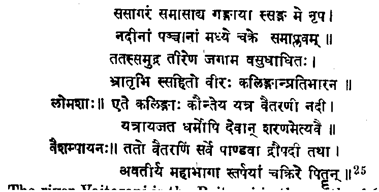
         The river Vaitarani is the Baitrani in the north of Orissa.
           The Utkalas mentioned  in the Raghuvamsa  are not
        spoken  of  in  the  edicts  of  Asoka,  nor  in  the
        inscriptions of Kharavela. Kalinga was then spoken of
        as one kingdom.  But in times subsequent  to those of
        Magadha  supremacy,  the  country  of  Kalinga, owing
        either  to racial  differences  or to the rise of the
        dormant   tribes,  must   have  been   divided   into
        Kauralaka.   Mahakantaraka,  and  Mahendragiri, --the
        Kautturaka  of the Allahabad  Pillar  inscription, or
        the  Udra,  Konyodha  and  Kalinga  of  Hiuen-Tsiang.
        Ut-kala  is  only  a  contraction  of Uttara-Kalinga,
        which means northern Kalinga.  When the northern part
        of Kalinga, which  is adjacent  to  the  kingdoms  of
        Northern  India,  associated   with  the  north,  the
        indigent  Dravidian  tribes, such as the Kuis and the
        Savaras, combined with the immigrant peoples from the
        south  (Dramilas) and associated  the  southern  part
        with Southern India.  So the northern  peoples became
        known   as  the  people   of  Northern   Kalinga,  or
        Uttara-Kalingas   or  Ut-Kalas,  while  the  southern
        inhabitants   were   called   Kalingas.   When   this
        separation  was  brought  about  cannot  be precisely
        stated, but it must  have  happened  in the time that
        intervened     between    Kharavela's     time    and
        Samudragupta's  invasion--a period of oblivion in the
        history  of the eastern part of the Gangetic  valley.
        It is clear, however, that Kalinga lay immediately to
        the south of Bengal, which then formed  a part of the
        kingdom of Asoka.

        -----------------------
        22 Mahabharata, Adi Parva, canto 143; Machchi Purana,
           Adyaya  48;  Vishnu Purana, by H.  H.  Wilson, pp.
           144, Amsa 4, Adhyaya 23.
        23 JASB., vol. LXVI, part I No. 2 (1897).
        24 Katha Sarit Sagar, supra.
        25 Mahabharata, Vana Parva.


                           p.87

            When  Asoka  ascended  the throne  of Magadha  he
        found  that  Kalinga  abutted  on his Kingdom  on the
        south.  It was a powerful civilised neighbour  of the
        Great  Mauryan  Ruler.  "  In  such  a country  dwell
        Brahmans  and ascetics, men  of different  sects  and
        house-holders, who all practise obedience  to elders,
        obedience  to father end mother, proper treatment  of
        friends,  acquaintances, comrades, relatives, slaves,
        and servants with fidelity of devotion."

            Difference in religion may have been the cause of
        the war that Asoka  waged against  Kalinga.  From the
        records of Kharavela we learn that Jainism, which was
        contemporaneous   with  Buddhism,  was  followed   in
        Kalinga, while Brahmanism  was the state religion  in
        Magadha.  Asoka himself  admits that he acquired  the
        Law  of Piety  " on seeing  the atrocities  committed
        when Kalinga was subdued by the force of arms."(26) "
        Asoka was," by the preachings  of a young ascetic, "
        constrained  to abandon the Brahmanical  faith of his
        father and to accept as a lay disciple the sacred law
        of Buddha.(27) The Asokavadana  says  that  on seeing
        the   miracle   shown   by  a  holy   ascetic   named
        Balapandita, Asoka  embraced  the true  religion  and
        forsook  the paths of wickedness.  The conversion  of
        Asoka seems to have happened  after Kalinga  had been
        conquered.  It must  have  been  the Brahmans, always
        opposed to Buddhism and Jainism, who advised Asoka to
        subdue Kalinga and destroy the Anti-Brahman  religion
        prevalent  there.  This fact  is corroborated  by the
        Daladavamsa:--"  When  the  remains  of  Buddha, were
        distributed  amongst  his disciples, the left  canine
        tooth  of the  lower  jaw fell  to the  lot of one of
        them.  He brought  it to Kalinga  and  built  a small
        stupa over it. Seeing the miracles worked by it, many
        people gathered  round it and a big city named Danfa-
        pura  rose  round  it.   The  Brahmans,  envying  the
        popularity of Buddhism, advised Guha-Siva, the King
        of Kalinga, to destroy  the  stupa  and  the city  of
        Dantapura. But by the  miracles  shown  by the tooth,
        Guha-Siva   embraced   Buddhism.   Then   Asoka,  the
        overlord,  was  induced   to  punish  Guha-Siva,  and
        destroy Dantapura. But the tooth appeared to Asoka in
        a dream and by means of ifs miracles converted him to
        Buddhism."

            Kalinga  was  a powerful  kingdom  and an adverse
        religion  was  followed  there.  It became  therefore
        necessary  to subdue it, but when attempts to conquer
        it were  made it showed  a bold  front.  A great  and
        bloody war ensued.  " One hundred  and fifty thousand
        persons were thence carried away captive; one hundred
        thousand  were  slain  and  many  times  that  number
        perished."  Having thus conquered  it, Asoka found it
        necessary to establish two sets of governing  bodies,
        one to carry on the provincial administration and the
        other to control  the border  tribes.  The former was
        placed  at  Tosali  and  the  latter  at Samapa.  The
        administrative  genius exhibited  here by the Mauryan
        Emperor is akin to that of the British administration
        of the North-Western Frontier Territory.

            The need of a frontier administration  proves the
        existence  of uncivilised  and troublesome  forest
        tribes on the borders of Kalinga. Which border was it
        ? On the west  there  are the  Eastern  Ghats, beyond
        which  in aftertimes  rose  up the  kingdom  of South
        Kosala. These Ghats, being difficult to cross, formed
        a safe protection  on the west.  On the south no such
        protection  existed  and the forest tribes  also were
        very troublesome.  Kharavela speaks of having planted
        a pillar  of victory  in Chataka  (Chikati) which  is
        even  now  inhabited  by  Savaras  and  other  forest
        tribes.  "The Kingdom of Mahakantara" is mentioned by
        Samudragupta. The name itself tells us that it was a
        great forest.  The Konyodha spoken of by Hiuen-Tsiang
        suggests  that  it was  a kingdom  of Kondhs, of  the
        class of "forest

        -------------------------
        26 Edict xiii.
        27 The Ceylonese legend: Asoka by V. A. smith.


                           p.88

        tribes."  All  these  refer  to  one  and  the   same
        tract  of country  lying  on the southern  border  of
        Asokan  Kalinga.  Raghu  is said to have marched  his
        armies through  a forest after he had vanquished  the
        king of Kalinga.  King Vatsa  also similarly  led his
        invading army through a forest, after he had captured
        the Mahendra, mountain.

            Even  in  these  days  the  country   about  this
        mountain  forms the home of the Savaras, the Kuis and
        other  forest  tribes.  The Savaras  must  have  been
        partly civilised, for they were hospitable  and Rama
        was hospitably  received by a Savara lady.  They have
        always been powerful  and warlike, and they fought in
        the  war  of Mahabharata.  Therefore  it is no wonder
        that Asoka tried to put a check upon them. A constant
        watch  had  to be put  on them, for  they  distrusted
        Asoka, as he was foreign to them. This is why he says
        :--" I desire them to trust me and to be assured  that
        they will receive from me happiness, and not sorrow."
        So he instructs his border officers to " inspire this
        folk with trust, so that they may be convinced that
        the king is unto  them even  as a father, and that as
        he cares  for himself, so he cares  for them, who are
        as the king's children." (28) With these bits of good
        advice  were  however  mingled   threats  to  overawe
        them: --"  Shun   evil-doing   that   ye  may  escape
        destruction."  It was only  after  the annexation  of
        Kalinga that the monarch's heart became sensitive  to
        pain and misery. He himself confesses it:--" The loss
        of even  the hundredth  or the thousandth part of the
        persons, who were then slain, carried  away  captive,
        or done to death in Kalinga, would now be a matter of
        deep regret to H is Majesty." Toleration of religion,
        kindness to animals, and all such morals were adopted
        after the conquest of Kalinga. To preach these morals
        to and  oontrol  the  border  tribes, officials  were
        appointed  and were placed  in such  a position  that
        might  freely   mix  with  the  borderers   and  give
        instructions:--" I expect to be well served  by you in
        this business, because you are in a position enabling
        you to inspire  these  folk with trust  and to secure
        their  happiness."  The officials  were expected  to "
        display  persevering  energy  in inspiring  trust  in
        these  borderers  and guiding  them  in the  path  of
        Piety."  These things could not have been done unless
        the responsible  officials  had lived in the midst of
        the forest tribes.

            A`soka,in his zeal to promulgate his Law of Piety
        and his pious  works, had all  his  edicts  set up in
        every place where he could find a favourable space to
        carve them upon.  Among the places in which they were
        set  up and  stillexist  are Dhauli  and  Jaugada  in
        Kalinga. Which of them was nearest the border ? It has
        already been pointed that the borderers were in the
        -South   of  Kalinga,  i.e.,  in  the   tract   about
        Mahendragiri. Moreover,  the  Borderers'  Edict  at
        Jaugada is in better preservation  than its duplicate
        at Dhauli;while  the Provincials'  Edict at Dhauli is
        better preserved  than its duplicate  at Jaugada.  If
        the respective states of preservation  bad been due
        to the work  of wind  and rain, both  the edicts  in
        both the places  would have been equally effected.
        This inequality of preservation  cannot be due to the
        destructive  ravages of the Muhammadan invaders, or
        of the Pindari.  and Thag hordes, for they would have
        tried to destroy the whole inscribed  surface and not
        only  particular  parts  of  it.  The  phenomenon  is
        probably due to the care of the border officers being
        specially  bestowed only on the Edict which ooncerned
        them, to the neglect  of the others.  For this reason
        Jaugrtda  must be held to be nearest  the border, and
        that border to be the southern  one, where there are
        troublesome border tribes.

            It is now necessary  to locate the bead-quarters
        of the frontier  control. Tosali, the seat of the
        Viceroy of Kalinga, is mentioned by Ptolemy in his
        Ancient India. The vestiges of a large city  have
        been discovered  not far from the site  of the monument
        at Dhauli. (29) The

        -----------------------
        28 Compare the Instructions  to the Provincials  with
           these lines.
        29 McKrindle's Ptolemy.


                           p.89

        position  of Tosali  having been thus defined, we
        must seek for that of Samapa. Although the Borderers'
        Edict is at Jaugada, there are those who presume that
        the southern  border  was far south, near Pulicat  or
        Rajahmandry.  Yet a study of the distribution  of the
        Pillar  and  Rock  Edicts  of Asoka  shows  that  the
        material  selected  for carving the inscriptions  was
        adapted  to the  physical  nature  of the country  in
        which the edict was intended to be published. Thus in
        the Gangetic  valley, where  a stone  as big as a pea
        cannot  be obtained, big blocks  of stone shaped into
        the form of pillars had to be brought from a distance
        and set up with the edicts already carved on them. In
        places  like Sanchi, where suitable  structures  were
        already  existing, a foct-step, or  a  railing, or  a
        pillar  of  a  railing  would  offer  a surface  for
        engraving, not a command  or a moral  doctrine, but a
        gift or an offering  to the holy shrine.  Rocks  were
        selected  to  record  the  edicts  where  there  were
        natural   boulders.    Now,   these   Asokan   Edicts
        approximately  give  us  the  limits  of the  Mauryan
        Empire,  and  had  Kalinga   run  so  far  south   as
        Rajahmandry, the Mauryan Emperor  would not have been
        at a loss to find, near the banks  of the Godavary, a
        boulder similar to the one at Jaugada.  Had the caves
        and topes at Guntapalle flourished during the time of
        Davanampriya,  a  pillar  or  a  railing  would  have
        offered  a face to carve an edict or a gift upon, but
        they did not then exist.  A comparative  study of the
        characters  in the Asokan  Edicts  and  those  of the
        inscriptions    discovered    in   the    Guntapalle
        excavations  will show that they quite  disagree, and
        thus it is proved that they do not belong to the same
        period.   Indeed,  from   the   paleography   of  the
        inscriptions  discovered  in the Guntapalle caves, it
        may be safely asserted that the caves and other local
        specimens of architecture belong to a time later than
        that of Asoka.

            Thus it appears to be clear that Jaugada  is near
        the southern  frontier  of Kalinga.  Samapa  must  be
        searched for near it. In fact Jaugada itself may have
        been  Samapa, for there  is the rock with  the edicts
        upon it, surrounded by a fort, the ruins of which are
        to be seen even now.  The following  is a description
        of the Jaugada rock and the fort, taken from Sewell's
        Lists:--" It  is situated  on the  site  of a large
        city, surrounded  by a fort wall.  The inscribed rock
        is  one  of  a  group  inside  the  fort.   It  rises
        vertically   and  the  inscribed  surface  faces  the
        south-east.  Numbers  of copper coins have been found
        close  by the  Jaugada  fort.  Old pottery  and tiles
        abound  within  the fort wall."  The Ganjam  District
        Manual  gives the following  account  of the place:--"
        What the enclosure was it is not possible to say.  It
        seems  too large  for a 'fort  ';it is a long square,
        the  opposite  faces  being  858 yards  by 814  yards
        respectively.  The bank, an earthen one, even now, in
        places is 18 feet high and 148 1/2 ft.  across at the
        base  and it has two entrances  on each side.  Inside
        are found  old tiles and debris  of houses, and coins
        after  rain and in ploughing;  but for the most  part
        the coins are copper ones......"

            The Asokan Edicts  do not say anything  of a fort
        having  been  built  there  by  Asoka.   Moreover,  a
        monarch, who entirely trusted to the efficacy  of his
        Law of Piety  for good government, had very little
        need  of  forts   and  strongholds.   Asoka  depended
        entirely upon the moral co-operation  of his subjects
        for  the  defence  of  his  dominions.   The  foreign
        princes, whose  kingdoms  bordered  on that  of Asoka
        were held in the pious  bond of the Law of Piety  and
        were  prevented  from  territoral  aggression.   Thus
        enjoying internal  peace and having no fear of attack
        from outside, Devanampriya  had full tranquillity  of
        mind  when  visiting  the holy  places  and  building
        stupas and erecting votive pillars and monuments.

            " Jaugada  " means the " Lac Fort." Its name of '
        Lac ' is from a tradition  that  it was made of 'Lac'
        and  was therefore  impregnable, for  no enemy  could
        scale  the walls  because  they were  too smooth  and
        slippery;  hut its impregnability  was destroyed by a
        spy who let


                           p.90

        the  adversary  into  the   secret  that  tire  would
        melt the stuff." (30) The fort however appears to have
        been built in times subsequent to Asoka's.

            The rocks  here are geologically  connected  with
        the Eastern Ghats, and the place is now surrounded by
        Peddakemidi, Chinna Kemidi, and other parts of Ganjam
        District, where  malaria  and other  kinds  of forest
        diseases  are rife.  In those ancient  days, however,
        the region  may have  been  even  more  unhealthy.  A
        benign  sovereign, who treated  his people as his own
        children, would  not  expose  his  officers  to  this
        unhealthy region. At the present day the officers for
        the administration  of the Agency tracts of the three
        northernmost  districts of the Madras Presidency have
        their head-quarters at Vizagapatam, a healthy town on
        the sea coast, and the Kalinga rulers of old are also
        said to have greatly  appreciated  life on the coast.
        The palace of the King of Kalinga was on the seashore
        :--

            " The ocean  itself, the waves  of which are seen
        from  the  windows   of  his  palace,  and  the  deep
        resounding  roars  of which surpass  the sound of the
        watch  drum, being  close  at hand, awakes  him as it
        were, when asleep in his palace-room."

            At  the  approach  of  the  spring, the  King  of
        Kalinga  retired  to the shore  with  his family  and
        subjects to celebrate the vernal festivities.


            " In that season, when the various creepers dance
        according  to the instruction  given by their  tutor,
        the cool breeze  that is embraced  by the sandal-wood
        trees on the slopes of the Dardura  hill, the King of
        Kalinga, accompanied  by his women folk, his daughter
        and  his  townsmen,  became  engaged  in  sport   for
        thirteen  days  in the pleasure  garden  on the sea-
        shore, which is impenetrable  to the rays of the sun,
        where the sand-banks are swept by the tendrils of the
        creepers that are bent by the perching of the humming
        bees, and which  is cooled  by the spray of the waves
        that play constantly."

            Communications with other countries was mostly by
        sea.  The Andhra  king comes over the sea and carries
        away  the King  of Kalinga  and his family.(33) Great
        and  constant   was  the  intercourse   with   Ceylon
        (Iramandalam) .  The  people  of  Ceylon  established
        colonies.  Hiramandalam, Hirapuram in the Parlakimidy
        Taluk, Hira Khandi in Dharakota  Zamindari, Hirapalli
        in Gumsur Taluk, Hirapalli  in Attagada Zamindari  of
        the  Ganjam  District, are all remnants  of Ceylonese
        colonisation  in  Kalinga.  Kalingapura,  the  modern
        Polannaruwa  in  Ceylon, reminds  us of the  great
        friendship  that  existed  between  that  Island  and
        Kalinga,.  The left canine  tooth of the lower jaw of
        Buddha, which was found in the Ceylon  stupas  and is
        now  deposited  in the British  Museum, was taken  to
        Ceylon   from  Kalinga   after  the  destruction   of
        Dantapura.

        ------------------------
        30 Ganjam District Gazette.
        31 Raghu Vamsa, Canto 6.
        32 Dasakumara Oharitra, Canto 7.
        33 Ganjam District Manual.


                           p.91

            For such maritime  intercourse  there  must  be a
        port convenient  for anchorage  and safe from storms.
        Baruva   at  the  mouth  of  the  Mahendratanaya   is
        mentioned  by Pliny as the point from which the ships
        coming  from the south turned  to cross to Chryse.  "
        Baruva, being only 16 miles from Mahendragiri, is the
        nearest port and can be seen from the bungalow on the
        hill.(34) Even now native passengers  from Burmah are
        frequently  landed  at Baruva.  There are two temples
        there, reputed  to have  been built  by the Pandavas,
        and it is near  by that  the Kottura  of Samudragupta
        must be placed.

            It is in this region near the southern  border of
        Kalinga, and almost  in the  vicinity  of the  Savara
        region,  and  having   a  good  sea-port,  that   the
        situation of Samapa must be sought.

            The word Samapa is formed of Sama (even or level)
        and apa (water).  The name  signifies that it is a
        town  built  in the  region  of level  water, i.e., a
        level  country.  In old days towns and villages  were
        given names signifying  the natural condition  of the
        country  in which they were built.  To make this name
        more significant ' ta ' (earth) was added as an affix
        in subsequent times.  'Samapata'(35) in the days when
        the  people  from  the  south  came  and  settled  in
        Kalinga, became  'Samapeta,'  then  'Sampeta,'  which
        easily  became  'Sompeta.'  'Dramilas,' the modern
        'Dravidas,' were defeated by Raja Raja, the father of
        Anantavarma  Choda Ganga.(36) Dimila  in Vizagapatam
        District  and Dimilas in Ganjam District remind us of
        the settlement  of the country by the people from the
        south.

            'Sompeta'  is  the  head-quarters   of  a  Deputy
        Tahsildar and native Magistrate.The village is situated
        partly  in  the  Talatampara  mutah  of  the  Chikati
        estate, and partly in that of Jalantara.  The country
        around  is level  and fertile.  Uddanam  is a fertile
        tract adjoining  Sompeta, where there are flourishing
        gardens   of  fruit  trees.   Plantains,  jack-fruit,
        oranges  and other kinds of fruit  are so plentifully
        grown that they are supplied not only to the whole of
        Ganjam  District   but  to  the  adjacent   parts  of
        Vizagapatam.  Talatampara, which means 'a low marsh '
        is only two miles from Sompeta and reminds  us of the
        original  level  nature  of the land.  Some old coins
        also  are  reported  to exist  here.(37) Kottura, the
        modern  Kotturu, lies  only two miles  north-east  of
        Sompeta.

            Kanchili,  two  miles   by  road  from   Sompeta,
        contains  images and temples  of great antiquity.  An
        old  temple, said  to  date  from  the  time  of the
        Pandavas,  exists  at  Pottangi,  which  is  6  miles
        south-west of Sompeta.  Inscriptions also are said to
        exist in this village.  Patasapuram, which is only
        one  mile  from  Sompeta,  contains  inscriptions  in
        unknown characters.  Mahendragiri, the most important
        land-mark of Kalinga, is 15 miles west of Sompeta.

            Its  nearness  to the capital  of the Kalinga  of
        Samudragupta's  times, and its closeness  to the port
        of Baruva  mentioned  by Ptolemy, clearly  prove that
        Sompeta  was  the  Samapa  of  Asoka;  and  it is the
        nearest  to the habitat  of the Savaras, the powerful
        tribes for whose control  the great and pious Mauryan
        Emperor issued Edicts of advice.

        -----------------------
        34 Ganjam District Manual.
        35 Sampa-ti-puram  in Anakapalli Taluk of Vizagapatam
           Distric, appears to have got its name from Samapa.
           'Ti' is an evidence  of 'ta', being  added to make
           the sense more clear.
        36 Ind. Ant., vol. XVIII, June 1889, No. 179.
        37 Sewell's Lists.